
Birbhum district (IPA: ) is an administrative unit in the Indian state of West Bengal. It is the northernmost district of Burdwan division—one of the five administrative divisions of West Bengal. The district headquarters is in Suri. Other important cities are Bolpur, Rampurhat and Sainthia. Jamtara, Dumka and Pakur districts of the state of Jharkhand lie at the western border of this district; the border in other directions is covered by the districts of Bardhaman and Murshidabad of West Bengal.
Often called “the land of red soil”, Birbhum is noted for its topography and its cultural heritage which is somewhat different from the other districts in West Bengal. The western part of Birbhum is a bushy region, a part of the Chota Nagpur Plateau. This region gradually merges with the fertile alluvial farmlands in the east.
This district saw many cultural and religious movements in history. The Visva Bharati University at Santiniketan, established by Rabindranath Tagore, is one of the places Birbhum is known for. Many festivals are celebrated in the district, including Poush Mela.
Birbhum is primarily an agricultural district with around 75% of the population being dependent on agriculture. Principal industries of the district include cotton and silk harvesting and weaving, rice and oilseed milling, lac harvesting, stone mining and metalware and pottery manufacture. Bakreshwar Thermal Power Station is the only heavy industry in the district.
Etymology
The name Birbhum comes probably from the term ‘land’ (‘bhumi’) of the ‘brave’ (‘bir’) or Bir king’). Another theory says that the district bears the name of Bagdi king Bir Malla, who ruled in the area from 1501 to 1554 CE. Bir in the Santali language means forests; therefore, Birbhum could also mean a land of forests.
Geography

Map of Birbhum district showing CD blocks and municipal areas
Situated between 23° 32′ 30″ (right above the tropic of cancer) and 24° 35′ 0″ north latitude and 87° 5′ 25″ and 88° 1′ 40″ east longitudes, and about 4,545 square kilometres (1,755 sq mi) in area, this district is triangular. River Ajay forms the southern base and the apex of the triangle points north. The river forms the boundary between the districts of Birbhum and Bardhaman. The state of Jharkhand is at the northern and the western border of Birbhum and Murshidabad is at the east.
Geographically, this area lies at the northeastern end of the Chota Nagpur Plateau, as it slopes down and merges with the alluvial plains of the Ganges. In the district there is only hilly area of natural rock formation situated near Dubrajpur town called Mama Bhagne Pahar (Hill). The western portion of the district is historically known as Vajjabhumi or Bajrabhumi. It is an undulating upland that is generally barren. The comparatively more fertile eastern portion, constituting the northeastern Rarh region, merges with the Gangetic plain. Vajjabhumi is included in the Rarh region, and the rest of Rarh is called Sumha to differentiate it from Vajjabhumi.
Climate

Rivers and towns of Birbhum
The climate on the western side is dry and extreme but is relatively milder on the eastern side. During summer, the temperature can shoot well above 40 °C (104 °F) and in winters it can drop to around 6 °C (43 °F). Rainfall is higher in the western areas as compared to the eastern areas. The annual average rainfall in Rajnagar is 1,405 millimetres (55.3 in) and in Nanoor it is 1,212 millimetres (47.7 in), mostly in the monsoon months (June to October).
Climate and rainfall chart of Birbhum District:
| Month | Normal rainfall (in mm) |
|---|---|
| January | 9.7 |
| February | 23.2 |
| March | 23.3 |
| April | 40.7 |
| May | 88.7 |
| June | 234.2 |
| July | 324.5 |
| August | 295.7 |
| September | 258.2 |
| October | 105.4 |
| November | 17.5 |
| December | 9.4 |
| Yearly | 1430.5 |
Rivers
A number of rivers flow across Birbhum. Some of the most notable include Ajay, Mayurakshi, Kopai, Bakreshwar, Brahmani, Dwarka, Hinglo, and Bansloi. Almost all the rivers originate higher up on the Chota Nagpur plateau and flow across Birbhum in a west–east direction. During the monsoon season, the rivers flow high and swift compared to the dry summer season, resulting in a cycle of floods and droughts. The Mayurakshi provides irrigation for about 2,428 square kilometres (937 sq mi).
History
Prehistory

Terracota design depicting Ramayana war at Jayadev Kenduli

Statue of Rabindranath Tagore by K P Krishnakumar at Amar Kutir
The area now known as Birbhum was inhabited from pre-historic times. Some of the archaeological sites related to Pandu Rajar Dhibi of chalcolithic remains are located in Birbhum. Stone age implements have been found at several places in the district.
According to the old Jain book Acaranga Sutra, the last (24th) great Tirthankara Mahavira had wandered through this land, referred to as the “pathless country of Ladha in Vajjabhumi and Subbhabhumi (probably Suhma)” in the fifth century BCE. According to some historians, the spread of Jainism and Buddhism in the Rarh region was part of the process of Aryanisation of the area. Based on Divyabdan, a Buddhist text, Dr. Atul Sur has inferred that Gautam Buddha probably traversed this area to go to Pundravardhana and Samatata.
The Rarh region, once a part of the Maurya empire was later included in the empires of the imperial Guptas, Shashanka and Harshavardhana. After dismemberment of Harshavardhana’s empire, the region was ruled by the Palas, under whose rule Buddhism, particularly the Vajrayana cult, flourished. In the seventh century CE, the Chinese traveller Xuanzang described some of the monasteries he visited in the region. In the 12th century CE, the Sena dynasty took control of the area.
Medieval age

Krishna travelling to Mathura in a 17th-century painting from Birbhum
The region was ruled by Muslims in the 13th century CE, although their control over the western parts of the district appears to have been minimal, with true power resting in the hands of the local Hindu chiefs, known as the Bir Rajas (Bagdi Malla dynasty). The towns of Hetampur, Birsinghpur and Rajnagar contain their relics. Hetampur and Rajnagar Kingdoms ruled most of Birbhum and parts of Burdwan, Maldah and Jharkhand from Dubrajpur (meaning two kingdoms – Hetampur & Rajnagar). Minhaj-i-Siraj, the author of the Tabaqat-i-Nasiri, mentions Lakhnur as the thanah (headquarters) of the Rarh wing of the Muslim rule and an important frontier post. The location of Lakhnur, though not yet identified, falls in Birbhum.
Colonial era

1779 map of the Jungle Terry District.
The area which is now Birbhum district was badly impacted by the Great Bengal famine of 1770. Many villages were wiped out entirely, and even in large towns, over three quarters of households perished.
The administrative unit called Birbhum was first formed in 1787 under the British East India Company, as “District Beerbhoom”. The area had previously been administered as a part of Murshidabad district. The original district was much larger than its modern incarnation.
In the late 18th century, Birbhum and surrounding areas were affected by more famines followed by a peasants’ insurrection. Although the insurrection primarily targeted zamindars and the government, trading and manufacturing centres were also looted. In June 1789, the manufacturing town of Ilambazar was sacked, although it recovered and became a magnet for manufacturing and trade.
Until 1793, Birbhum included “Bishenpore” or Bishnupur, which is now part of the Bankura district. Until the 1857 Sepoy Mutiny, the Santhal Parganas was part of Birbhum; the district thus sprawled up to Deoghar in the west. The immediate reason then for separating the western tribal majority areas was the Santhal rebellion of 1855–56.
Economy

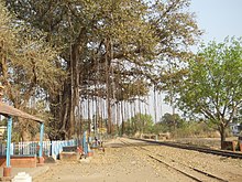
A common Birbhum village scene

Product display of Amar Kutir
Birbhum is primarily an agricultural district with around 75% of the people dependent on agriculture. While 159.3 km2 (61.5 sq mi) of land is occupied by forests, 3,329.05 km2 (1,285.35 sq mi) of land is used for agricultural purposes. 91.02% of the population live in villages. Out of total 4,50,313 farmers(holding 3,20,610 hectares of land), 3,59,404 are marginal farmers(holding 1,41,813 hectares altogether), 63,374 are small farmers(holding 95,144 hectares altogether), 26,236 are semi-medium farmers(holding 76,998 hectares altogether), 1,290 are medium farmers(holding 6,215 hectare altogether), and 9 are large farmers (holding 440 hectares of land). The average size of land holding per farmer is 0.71 hectares. 6,07,172 people work as agricultural labourers in Birbhum. Major crops produced in the district include rice, legumes, wheat, corn (maize), potatoes and sugar cane. The district has thirteen cold storages. Land with irrigation facilities in 2001-02 totalled 2,763.9 km2 (1,067.1 sq mi). There are five barrages, providing irrigation support. Canada Dam on the Mayurakshi river at Massanjore lies close to the border of Birbhum and the Dumka district in Jharkhand. Further down the Mayurakshi is the Tilpara Barrage at Suri.
Birbhum is a major centre of cottage industries. Perhaps the most notable cottage industry is a non-profit rural organisation named Amar Kutir. Other main industries in Birbhum are agriculture-based industries, textiles, forestry, arts and crafts. Sriniketan is noted for its dairy industry and as a forestry centre. Some of the notable forms of cottage industries of Birbhum include textile—especially cotton and locally harvested tussar silk, jute works, batik, kantha stitch, macramé (weaving by knotting threads), leather, pottery and terracotta, solapith, woodcarving, bamboo and cane craft, metal works and tribal crafts. There are 8,883 small and medium scale industries. Principal industries of the district include cotton and silk harvesting and weaving, rice and oilseed milling, lac harvesting, and metalware and pottery manufacture. Bakreshwar Thermal Power Station (210 MW x 3 + 210 MW x 2 under construction) is the only heavy industry in the district.
Sainthia is known as business capital of Birbhum and an economically important city. Sainthia is the major centre for export and import of cottage industries. Huge numbers of businesses run in this city and its economy stands tall due to sales of agricultural based products.
In 2006 the Ministry of Panchayati Raj named Birbhum one of the country’s 250 most backward districts (out of a total of 640). It is one of the eleven districts in West Bengal currently receiving funds from the Backward Regions Grant Fund Programme (BRGF).
Political and administrative divisions
The district comprises three subdivisions: Suri Sadar, Bolpur and Rampurhat. Suri is the district headquarters. There are 26 police stations, 19 development blocks, 6 municipalities and 167 gram panchayats in this district. Other than municipality area, each subdivision contains community development blocs which in turn are divided into rural areas and census towns. There are seven urban units: six municipalities and one census town. The latest amongst the urban units to have a municipality was Nalhati in 2000.
Before delimitation the district was divided into 12 assembly constituencies (AC):Nanoor (AC #283), Bolpur (AC #284), Labhpur (AC #285), Dubrajpur (AC #286), Rajnagar (AC #287), Suri (AC #288), Mahammad Bazar (AC #289), Mayureswar (AC #290), Rampurhat (AC #291), Hansan (AC #292), Nalhati (AC #293) and Murarai (AC #294). The constituencies of Nanoor, Rajnagar, Mayureswar and Hansan were reserved for Scheduled Castes (SC) candidates.Vidhan Sabha was elected in 2006 assembly elections, which took place before the rearrangement of parliamentary and assembly constituencies as per order of the Delimitation Commission in respect of the delimitation of constituencies in the West Bengal. Delimitation was made effective for all elections in the state of West Bengal that was held on or after 19 February 2008. 2009 Indian general election was based on the newly formed parliamentary constituencies and the newly formed assembly constituencies have representatives in the 2011 elections of West Bengal.
As per order of the Delimitation Commission in respect of the delimitation of constituencies in the West Bengal, the district is divided into 11 assembly constituencies: Dubrajpur (AC #284), Suri (AC #285), Bolpur (AC #286), Nanoor (AC #287), Labpur (AC #288), Sainthia (AC #289), Mayureswar (AC #290), Rampurhat (AC #291), Hansan (AC #292), Nalhati (AC #293) and Murarai (AC #294). Dubrajpur, Nanoor and Sainthia constituencies are reserved for Scheduled Castes (SC) candidates.
Dubrajpur, Suri,Mayureswar, Rampurhat, Hansan, Nalhati and Murarai assembly segments form the Birbhum (Lok Sabha constituency). Bolpur, Nanoor, Labhpur, and Sainthia constituencies are part of Bolpur (Lok Sabha constituency), which will contain three other assembly segments from Bardhaman district.
Transport
Katwa to Ahmedpur Narrow gauge railway
The Panagarh–Morgram Highway runs through the district. All the towns and villages are connected by roads. The total length of roads in the district are: surfaced–2,413 km (1,499 mi) and unsurfaced–4,674 km (2,904 mi). Against this the total length of rail track in the district is 201.32 km (125.09 mi), including 26.55 km (16.50 mi) of the Ahmadpur-Katwa line, laid in 1917. The Sahibganj Loop of the Eastern Railway, laid in 1862, passes through this district. There is a junction at Nalhati for the connection to Azimganj in Murshidabad district. The Andal-Sainthia Branch Line connects it to the main Howrah-Delhi main line at Andal.
Demographics
| Year | Pop. | ±% p.a. |
|---|---|---|
| 1901 | 902,280 | — |
| 1911 | 940,162 | +0.41% |
| 1921 | 851,725 | −0.98% |
| 1931 | 947,554 | +1.07% |
| 1941 | 1,048,317 | +1.02% |
| 1951 | 1,066,889 | +0.18% |
| 1961 | 1,446,158 | +3.09% |
| 1971 | 1,775,909 | +2.08% |
| 1981 | 2,095,829 | +1.67% |
| 1991 | 2,555,664 | +2.00% |
| 2001 | 3,015,422 | +1.67% |
| 2011 | 3,502,404 | +1.51% |
| source | ||
In 1901, Birbhum had a population of 902,280, which by 1981 rose to 2,095,829. According to the 2001 census data, the total population has further risen to 3,015,422. The following table summarises the population distribution:
| Rural/Urban | Persons | Males | Females |
|---|---|---|---|
| Total | 3,015,422 | 1,546,633 | 1,468,789 |
| Rural | 2,757,002 | 1,414,097 | 1,342,905 |
| Urban | 258,420 | 132,536 | 125,884 |
According to 2011 Indian census, Hindus formed around 62% of the total population with Muslims about 37%. Muslims are in majority in Murarai I, Murarai II and Nalhati II CD blocks in the northeast of the district, and have a significant presence in Nalhati I, Rampurhat II, and Ilambazar CD blocks. Others, including religious groups and non-religion population fall below 1% of the population. In the 2001 Indian census of the district, Hindus formed around 65% of the population while 33% were Muslims. There is a sprinkling of other religious groups in the population. According to the 2011 census, 29.5% of the population belong to the scheduled castes and 6.92% to the scheduled tribes. Other than those speaking the local dialect of Bengali, there are tribal Santhals and ten other tribal communities in Birbhum with some presence, amongst whom Koda, Mahali and Oraons are more common.
Religions of Birbhum District in 2011 census
Religion Percent
Hindus 62.28%
Muslims 37.06%
Other or not stated 0.66%
Languages of Birbhum District (2011).
Bengali (92.38%)
Santali (6.01%)
Others (1.61%)
According to the 2011 census Birbhum district has a population of 3,502,387, roughly equal to the nation of Lithuania or the US state of Connecticut. This gives it a ranking of 84th in India (out of a total of 640). The district has a population density of 771 inhabitants per square kilometre (2,000/sq mi). Its population growth rate over the decade 2001-2011 was 16.15%. Birbhum has a sex ratio of 956 females for every 1000 males, and a literacy rate of 70.9%.
Culture

Baul singers at Santiniketan
The bauls of Birbhum, their philosophy and their songs form a notable representation of the folk culture of the district. Birbhum has been home to kabiyals, kirtaniyas and other folk culture groups.
The numerous fairs in Birbhum start with Poush Mela at Santiniketan and follows through the Bengali month of Poush till Makar Sankranti. Particularly lively is the fair at Jaydev Kenduli. Festivities are organised across the seasons. People of Birbhum patronise folk entertainment programmes such as jatra, kavigan and alkap.
Many poets were born in this district, as for example, Chandidas (Rami). In addition to being a confluence of Vaishnava, Shakta and Saiva cultures, Birbhum villages observe ancient customs like worship of gramdevta (gram means village and devta means deity) in many forms.
Amongst the major attractions of Birbhum are Bakreshwar, Tarapith, Dwarbasini temple at Chondrapur and Patharchapuri. Birbhum has many old temples, such as the ones at Jaydev Kenduli, Surul and Nanoor, with delicate decorative tiles made of terra cotta (burnt clay).
Flora and fauna
The eastern area of Birbhum is a part of the rice plains of West Bengal, and the vegetation includes usual characteristics of rice fields in Bengal, such as species of Aponogeton, Utricularia, Drosera, Philcoxia, Scrophulariaceae and similar aquatic or palustrine genera. In the drier western region of the district, the characteristic shrubs and herbs include species of Wendlandia, Convolvulaceae, Stipa, Tragus, Spermacoce, Ziziphus, Capparis and similar plants that grows on laterite soil. Mango, palm, and bamboo are among common trees in Birbhum. Other common species of plants include jackfruit, arjun, sal, guava, kend and mahua.
Other than feral dogs and domestic cattle, the most frequently encountered non-human mammal is the hanuman, a long tailed grey langur prevalent in the Gangetic plain. Some wild boars and wolves may still be spotted in the small forests of Chinpai, Bandarsol and Charicha. Leopards and bears are not to be seen any more in the wild. Sometimes during the season when mahua trees bloom, wild Asiatic elephants from Jharkhand come in trampling crops and threatening life and property. Birds of Birbhum include a mix of hilly and plain-land dwelling species like partridge, pigeon, green pigeon, water fowls, doyel, Indian robin, drongo, hawk, cuckoo, koel, sunbird, Indian roller, parrot, babbler, and some migratory birds.
Ballabhpur Wildlife Sanctuary near Santiniketan was declared a sanctuary in 1977. Economically important trees are planted here and blackbucks, spotted deer, jackals, foxes and a variety of water birds live in its 2 km2 (0.8 sq mi).
Literacy and education
Educational facilities in Birbhum district:
High School–256
Higher Secondary School–110
Junior High School–95
Junior High Madarsa–10
Senior Madarsa–4
Primary School–237
Sishu Sikhsha Kendra–495
Anganwadi Centre–2407
College–12
University–1
Engineering colleges–2
Polytechnic–1Notable people
Rabindranath Tagore with Mahatma Gandhi and Kasturba Gandhi at Santiniketan in 1940
- Amartya Sen, economist and Nobel laureate
- Pranab Mukherjee, 13th President of India
- Tarasankar Bandyopadhyay, Bengali novelist
- Ekram Ali, Bengali poet and critic
- Sahana Bajpaie, Bengali singer-songwriter and one of the most prominent contemporary Rabindra Sangeet vocalists
- Sutapa Biswas, British Indian conceptual artist
- Ananda Mohan Chakrabarty, Indian American microbiologist, scientist, and researcher, most notable for his work in directed evolution
- Basudeb Das Baul, Bengali baul singer
- Sumitra Devi, actress who worked in Hindi and Bengali cinema during the 1940s and 1950s
- Kharaj Mukherjee, Indian actor who works in Bengali as well as Hindi cinema
- Chandidas Rami, 14th-century poet born in Nanoor
- Satyendra Prasanna Sinha, prominent lawyer and statesman in British India
- Nityananda Swami, co–founder of Vaishnavism, born at Ekachakra
- Rabindranath Tagore, polymath and founder of Visva-Bharati University
- Abdus Sattar, former President and Vice President of Bangladesh
- Mohammad Kibria, Bangladeshi artist
- Muhammad Qudrat-i-Khuda, Bangladeshi organic chemist, educationist and writer.
- Ganga Narayan Singh, Indian tribal revolutionary
Villages
- Kondaipur
