
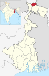
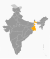
Jalpaiguri Division is one of the 5 divisions in the Indian state of West Bengal. It is the northernmost division of West Bengal. It is surrounded by Nepal on the western side, Bihar on South-Western side, Bhutan on the Northern side and Bangladesh on the southern side.
Districts

Districts of West Bengal
It consists of 5 districts:
| Code | District | Headquarters | Established | Sub-Division | Area | Population As of 2011 | Population Density | Map |
|---|---|---|---|---|---|---|---|---|
| DA | Darjeeling | Darjeeling | 1947 |
|
2,092.5 km2 (807.9 sq mi) | 1,797,422 | 859/km2 (2,220/sq mi) |
 |
| JP | Jalpaiguri | Jalpaiguri | 1947 |
|
2,844 km2 (1,098 sq mi) | 2,172,846 | 621/km2 (1,610/sq mi) |
 |
| KB | Cooch Behar | Cooch Behar | 1950 |
|
3,387 km2 (1,308 sq mi) | 2,822,780 | 833/km2 (2,160/sq mi) |
 |
| AD | Alipurduar | Alipurduar | 2014 |
|
3,383 km2 (1,306 sq mi) | 1,700,000 | 400/km2 (1,000/sq mi) |
 |
| KA | Kalimpong | Kalimpong | 2017 |
|
1,044 km2 (403 sq mi) | 251,642 | 239/km2 (620/sq mi) |
 |
| Total | 5 | — | – | 13 | 12,713 km2 (4,909 sq mi) | 8,790,397 | 691/km2 (1,790/sq mi) |
 |
Demographics
Hindus forms the majority of the population while Muslims forms the largest minority group. There is a significant Christian and Buddhist population in the division. They are mainly concentrated in Kalimpong district and hill subdivisions of Darjeeling district. The Dooars regions also has a significant tribal population.