
Kamjong District
is a district in Manipur state, India created by splitting Ukhrul district.
The district headquarters is located in Kamjong. Kamjong District is a newly created district on 8 December 2016 and shares a long international border with Myanmar. It is bounded by Myanmar in the east, Senapati in the West, Ukhrul in the North and Chandel in the South. The terrain of the district is hilly with varying heights of 913 m to 3114 m (MSL). The district headquarter is linked with state highway of 120 Km from Imphal.
About People
Kamjong district is mainly inhabited by the Tangkhul Nagas, comprising 94% of the total population with the Kukis comprising 4.59% of the district. Both Tangkhul nagas and Thadou-Kuki tribes comes under scheduled tribe, notified by the constitution of India and in CENSUS OF INDIA 2011 MANIPUR List of scheduled Castes and Scheduled Tribes[The scheduled Castes and Scheduled Tribes Orders, (Amendment) Act.1976 (No.108 of 1976, dated 18 September 1976 listed at 26. Tangkhul and 33. Any Kuki Tribes. Majority of the inhabitants of this district follow Christianity as their religion, which is notified as minority community Under Section 2 (C) of the National Commission for Minorities Act 1992.
|
Kamjong district
|
|
|---|---|
|
District
|
|
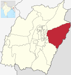
Location of Kamjong district in Manipur
|
|

Kamjong district
Location of Kamjong district in Manipur
|
|
| Coordinates (Kamjong): 24.86°N 94.50°ECoordinates: 24.86°N 94.50°E | |
| Country | |
| State | |
| Established | 2016 |
| Headquarters | Kamjong |
| Area | |
| • Total | 2,000 km2 (800 sq mi) |
| Population | |
| • Total | 45,616 |
| • Density | 23/km2 (59/sq mi) |
| Time zone | UTC+05:30 (IST) |

Sub-divisions
The following are the sub-divisions in Kamjong district:
- Kamjong
- Sahamphung
- Kasom Khullen
- Phungyar