
Bhojpur District (Nepali: भोजपुर जिल्ला (![]() listen)) is one of 14 districts of Province No. 1 of eastern Nepal. The district’s area is 1,507 km² with a population of 182,459 (2011). The administrative center is Bhojpur. It is surrounded by Dhankuta and Sankhuwasabha in the east, Khotang in the west, again Sankhuwasabha in north-east and Solukhumbu in the north-west and Udayapur in the South.
listen)) is one of 14 districts of Province No. 1 of eastern Nepal. The district’s area is 1,507 km² with a population of 182,459 (2011). The administrative center is Bhojpur. It is surrounded by Dhankuta and Sankhuwasabha in the east, Khotang in the west, again Sankhuwasabha in north-east and Solukhumbu in the north-west and Udayapur in the South.
Etymology
According to the DCC Bhojpur, this place was named after the Betula utilis. Betula utilis was found here in large quantities. The Nepali name for Betula utilis is “Bhojpatra” (भोजपत्र).
Bhojpur is a combination of two words “Bhoj” and “Pur”, Bhoj refers to Bhojpatra (Betula utilis) and “Pur refers to a place or city.
According to history, Prithvi Narayan Shah gave a big party after winning a battle in this place. The Meaning of “Bhojpur” means party and “Pur” meaning “buried”. After the party the food was more than enough for them and they were unable to eat it all. After that the Nepali armies buried all their wasted food here. So the name became Bhojpur.
Geography and climate
Classified as a Hill District, Bhojpur actually spans five of Nepal’s eight climate zones. 3% of the district’s area is below 300 meters elevation in the Lower Tropical zone and 31% is Upper Tropical from 300 to 1,000 meters. 50% of the land area belongs to the Subtropical Zone between 1,000 and 2,000 meters and 15% is Temperate (2,000 to 3,000 meters). 2% rises higher into the Subalpine Zone.
| Climate Zone | Elevation Range | % of Area |
|---|---|---|
| Lower Tropical | below 300 meters (1,000 ft) | 2.7% |
| Upper Tropical | 300 to 1,000 meters 1,000 to 3,300 ft. |
30.5% |
| Subtropical | 1,000 to 2,000 meters 3,300 to 6,600 ft. |
49.8% |
| Temperate | 2,000 to 3,000 meters 6,400 to 9,800 ft. |
15.1% |
| Subalpine | 3,000 to 4,000 meters 9,800 to 13,100 ft. |
1.7% |
Divisions
Bhojpur is divided into two urban and seven rural municipalities:
| No. | Type | Name | Population (2011) | Area | Wards | Website |
|---|---|---|---|---|---|---|
| 1 | Urban | Bhojpur | 28,107 | 159.51 | 12 | |
| 2 | Urban | Shadanand | 31,612 | 241 | 14 | |
| 3 | Rural | Hatuwagadhi | 20,404 | 142.61 | 9 | |
| 4 | Rural | Ramprasad Rai | 18,848 | 158.83 | 8 | |
| 5 | Rural | Aamchok | 18,720 | 184.89 | 10 | |
| 6 | Rural | Tyamke Maiyunm | 17,911 | 173.41 | 9 | |
| 7 | Rural | Arun Gaunpalika | 17,687 | 154.76 | 7 | |
| 8 | Rural | Pauwadungma | 15,394 | 118.86 | 6 | |
| 9 | Rural | Salpasilichho | 13,111 | 193.33 | 6 | |
| District | Bhojpur | 182,459 | 1,507 | 81 |
Towns and villages (former VDC)
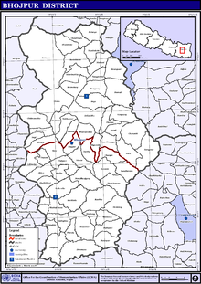
Map of the VDC/s in Bhojpur District
- Aangtep
- Annapurna
- Baikunthe
- Balankha
- Basikhora
- Basingtharpu
- Bastim
- Bhaisipankha
- Bhubal
- Bhulke
- Bokhim
- Bhojpur
- Boya
- Champe
- Changre
- Charambi
- Chaukidanda
- Chhinamakhu
- Dalgaun
- Deurali
- Dewantar
- Dhodalekhani
- Dobhane
- Dummana
- Gogane
- Gupteshwar
- Hasanpur
- Helauchha
- Homtang
- Jarayotar
- Kimalung
- Keurepani
- Khairang
- Khartimchha
- Khatamma
- Khawa
- Kot
- Kudak Kaule
- Kulunga
- Lekharka
- Mane Bhanjyang
- Mulpani
- Nagi
- Nepaledada
- Okhre
- Pangcha
- Patle Pani
- Pawala
- Pyauli
- Ranibas
- Sangpang
- Sano Dumba
- Shadanand Municipality
- Shyamsila
- Siddheshwar
- Sindrang
- Syamsila
- Taksar
- Thidingkha
- Thulo Dumba
- Timma
- Tiwari Bhanjyang
- Tunggochha
- Yaku
- Yangpang
- Chaukidada
Demographics
At the time of the 2011 Nepal census, Bhojpur District had a population of 182,459. Of these, 49.1% spoke Nepali, 19.6% Bantawa, 7.5% Tamang, 4.5% Newari, 3.4% Magar, 3.0% Dungmali, 2.4% Kulung, 2.0% Sampang, 1.5% Sherpa, 1.4% Rai, 1.2% Chamling and 0.7% Nachhiring as their first language.
48.5% of the population in the district spoke Nepali and 0.6% Bantawa as their second language.
53% of the population are female. Major ethnicities in the district are Rai (32%), Chhetri (20%), Tamang (9%), Newar (8%), Bahun (6%) and others (25%). The literacy rate is 69 percent.
2015 Nepal earthquake
The district was affected by an earthquake on 25 April 2015.