
Darjeeling District is the northernmost district of the state of West Bengal in eastern India in the foothills of the Himalayas. The district is famous for its hill station and Darjeeling tea. Darjeeling is the district headquarters.
Kurseong, Siliguri and Mirik, three major towns in the district, are the subdivisional headquarters of the district. Kalimpong was one of the subdivisions but on 14 February 2017, it officially became a separate Kalimpong district.
Geographically, the district can be divided into two broad divisions: the hills and the plains. The entire hilly region of the district comes under the Gorkhaland Territorial Administration, a semi-autonomous administrative body under the state government of West Bengal. This body covers the three hill subdivisions of Darjeeling, Kurseong and Mirik and the district of Kalimpong. The foothills of Darjeeling Himalayas, which comes under the Siliguri subdivision, is known as the Terai. The district is bounded on the north by Sikkim, on the south by Kishanganj district of Bihar state, on the southeast by Panchagarh district of Bangladesh, on the east by Kalimpong and Jalpaiguri districts, and on the west by easternmost Province No. 1 of Nepal. Darjeeling district has a length from north to south of 18 miles (29 km) and a breadth from east to west of 16 miles (26 km). As of 2011, it was the second least populous district of West Bengal (out of 19), after Dakshin Dinajpur.
Name
The etymological term of Darjeeling is denoted “Tajenglung”, a Yakthung Limbu terminology that means the stones that “talk to each other”, according to the historian Sankarhang Subba of Darjeeling. The name Darjeeling acclaimed from the Tibetan words Dorje, which is the thunderbolt sceptre of the Hindu deity Indra, and ling, which means “a place” or “land”.
History
The ancient inhabitants of Darjeeling are the Lepcha and Limbu.
Most of Darjeeling formed a part of dominions of the Chogyal of Sikkim, who had been engaged in an unsuccessful warfare against the Gorkhas of Nepal. From 1780, the Gorkhas made several attempts to capture the entire region of Darjeeling. By the beginning of the 19th century, they had overrun Sikkim as far eastward as the Teesta River and had conquered and annexed the entire Terai.
In the meantime, the British were engaged in preventing the Gorkhas from over-running the whole of the northern frontier. The Anglo-Gorkha war broke out in 1814, which resulted in the defeat of the Gorkhas and subsequently led to the signing of the Sugauli Treaty in 1815. According to the treaty, Nepal had to cede all those territories which the Gorkhas had annexed from the Chogyal of Sikkim to the British East India Company (i.e., the area between Mechi River and Teesta River). In 1817, through the Treaty of Titalia, the British East India Company reinstated the Chogyal of Sikkim, restored all the tracts of land between the Mechi and the Teesta rivers to the Chogyal of Sikkim and guaranteed his sovereignty. In 1835, the hill of Darjeeling, including an enclave of 138 square miles (360 km2), was given to the British East India Company by Sikkim.
In November 1864, the Treaty of Sinchula was executed in which the Bhutan Dooars with the passes leading into the hills and Kalimpong were ceded to the British by Bhutan. The Darjeeling district can be said to have assumed its present shape and size in 1866 with an area of 1234 sq. miles.
Before 1861 and from 1870 to 1874, Darjeeling District was a “Non-Regulated Area” (where acts and regulations of the British Raj did not automatically apply in the district in line with rest of the country, unless specifically extended). From 1862 to 1870, it was considered a “Regulated Area”. The phrase “Non-Regulated Area” was changed to “Scheduled District” in 1874 and again to “Backward Tracts” in 1919. The status was known as “Partially Excluded Area” from 1935 until the independence of India.
On 14 February 2017, Kalimpong district was carved out of Darjeeling district.
Gorkhaland Movement

The GNLF flag.
During the 1980s, the Gorkha National Liberation Front led an intensive and often violent campaign for the creation of a separate Gorkhaland state within India, across the Nepali-speaking areas in northern West Bengal. The movement reached its peak around 1986–1988 but ended with the establishment of the Darjeeling Gorkha Hill Council in 1988.
The hill areas of Darjeeling enjoyed some measure of autonomy under the Darjeeling Gorkha Hill Council. However, the demand for full statehood within India has emerged once again, with the Gorkha Janmukti Morcha as its chief proponent. The Gorkhaland Territorial Administration replaced the DGHC in August 2012 after the GJM signed an agreement with the government.
Geography
Batasia Loop, Darjeeling

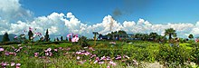
A tea garden in Darjeeling.
The Darjeeling hill area is formed of comparatively recent rock structure that has a direct bearing on landslides. Heavy monsoon precipitation contributes to the landslides. Soils of Darjeeling hill areas are extremely varied, depending on elevation, degree of slope, vegetative cover and geolithology.
The Himalayas serve as the source of natural resources for the population residing in the hills as well as in the plains. As human population expands in the hills, forests are being depleted for the extension of agricultural lands, introduction of new settlements, roadways, etc. The growing changes coming in the wake of urbanisation and industrialisation leave deep impressions on the hill ecosystem.

Coronation Bridge over Teesta river.
The economy of Darjeeling hill area depends on tea production, horticulture, agriculture, forestry and tourism. The major portions of the forests are today found at elevations of 2,000 metres (6,600 ft) and above. The area in between 1,000 and 2,000 metres (3,300 and 6,600 ft) is cleared either for tea plantation or cultivation. About 30 percent of the forest covers found in the lower hills are deciduous. Evergreen forest constitutes only about 6 percent of the total forest coverage. Shorea robusta remains the most prominent species of tropical moist deciduous forest along with heavy undergrowth.
Teesta, Rangeet, Mechi, Balason, Mahananda and Rammam are the important rivers of the district.
Climate
| hideClimate data for Darjeeling | |||||||||||||
|---|---|---|---|---|---|---|---|---|---|---|---|---|---|
| Month | Jan | Feb | Mar | Apr | May | Jun | Jul | Aug | Sep | Oct | Nov | Dec | Year |
| Record high °C (°F) | 16 (61) |
17 (63) |
23 (73) |
24 (75) |
25 (77) |
24 (75) |
25 (77) |
25 (77) |
25 (77) |
23 (73) |
19 (66) |
17 (63) |
25 (77) |
| Average high °C (°F) | 8 (46) |
9 (48) |
14 (57) |
17 (63) |
18 (64) |
18 (64) |
19 (66) |
18 (64) |
18 (64) |
16 (61) |
12 (54) |
9 (48) |
15 (58) |
| Average low °C (°F) | 2 (36) |
2 (36) |
6 (43) |
9 (48) |
12 (54) |
13 (55) |
14 (57) |
14 (57) |
13 (55) |
10 (50) |
6 (43) |
3 (37) |
9 (48) |
| Record low °C (°F) | −3 (27) |
−2 (28) |
−1 (30) |
1 (34) |
6 (43) |
8 (46) |
9 (48) |
11 (52) |
10 | ||||