
Chittoor district, is one of the four districts in the Rayalaseema region of the Indian state of Andhra Pradesh. The district headquarters is located at Chittoor. It has a population of 4,170,468 according to 2011 census of India. Chittoor district has many major temples including Tirupati, Srikalahasti, Kanipakam, and other temples. It lies in the Poini river valley of southernmost Andhra Pradesh along the Chennai – Bangalore section of Chennai-Mumbai highway. Chittoor district is a major market centre for mangoes, grains, sugarcane, and peanuts. Sricity integrated business city lies in Satyavedu mandal; it acts as a major industrial hub for Chittoor district as well as Andhra Pradesh as a whole.
Etymology
The district derived its name from its headquarters Chittoor.
History
After the Indian independence in 1947, Chittoor became a part of the erstwhile Madras state. The modern Chittoor District was formerly Arcot District, which was established by the British in the 19th century had Chittoor as its headquarters . On 1 April 1911, district was split into Chittoor District and North Arcot Districts.
Chittoor District was formed on 1 April 1911, taking Chittoor, Palamaneru, Chandragiri from the then North Arcot District of Madras State and Madanapalli, Vayalpadu from Kadapa and Punganur, Sri Kalahasti, Karvetinagar from Zamindari tahsils of the Chittoor district to form united Chittoor district. In 1960, 319 villages in Chittoor district were added into Chingleput District now Kanchipuram district and Thiruvallur districts of Tamil Nadu and subsequently Sathyavedu and Kuppam of Chingleput District was transferred to Chittoor district on linguistic basis based on the Act called The Andhra Pradesh And Madras (Alteration Of Boundaries) Act, 1959.
Chandragiri, a suburban area of Tirupati served as fourth capital of Vijayanagar empire.
Geography

Districts of Andhra Pradesh
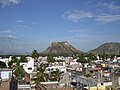
Chittoor is a part of Rayalaseema region of Andhra Pradesh. The district occupies an area of 15,359 square kilometres (5,930 sq mi). The district is bounded by Anantapur District to the northwest, Kadapa District to the north, Nellore District to the northeast, Krishnagiri District, Vellore District, Tirupathur district and Tiruvallur District of Tamil Nadu state to the south, Chikballapur district and Kolar District of Karnataka state to the west. Chittoor district lies extreme south of the Andhra Pradesh state approximately between 12°37′ – 14°8′ north latitudes and 78°3′ – 79°55′ east longitudes. Thirty percent of the total land area is covered by forests in the district. Mango and tamarind groves surround the city of Chittoor, and cattle are raised in the district. The soils in the district constitute red loamy 57%, red sandy 34% and the remaining 9% is covered by black clay black loamy, black sandy and red clay Chittoor is 160 km from Chennai, 180 km from Bangalore and 590 km from Hyderabad.
Hydrology and climate
The important rivers in the district are Ponnai and Swarnamukhi rivers which originate in eastern ghats. Other rivers include Kusasthali, Beema, Bahuda, Pincha, Kalyani, Araniyar and Pedderu. None of the rivers are perennial. Main rivers include Swarnamukhi, Kalangi, Papaghni, Koundinya, Pileru, Arani, Pinchcha, Cheyyeru, Neeva and Kusasthali. The district has a very short coastine, bordered by the Bay of Bengal. The temperature in the western parts of the district like Punganur, Madanapalle, Horsley Hills are relatively lower than the eastern parts of the Chittoor District. This is because of the higher altitude of the western parts compared to the eastern parts. The summer temperatures touches 44 °C in the eastern parts whereas in the western parts it ranges around 36° to 38 °C. Similarly the winter temperatures of the western parts are relatively low ranging around 12 °C to 14 °C and in eastern parts it is 16 °C to 18 °C. Most of a district has a Tropical wet and dry climte, with some north-western parts having Hot semi-arid climate.
Chittoor district receives an annual rainfall of 918.1 mm. The South West Monsoon and North East Monsoon are the major sources of rainfall for the district. On average the district receives 438.0 mm of rainfall through the South West Monsoon (From June to September) and 396.0 mm from North East Monsoon (From October to December). The rainfall received by the district in the years 2002 and 2003 are 984.2 mm and 934 mm respectively.
Demographics
According to the 2011 census Chittoor district has a population of 4,174,064. This gives it a ranking of 47th in India (out of a total of 640)and 6th in its state. The district has a population density of 275 inhabitants per square kilometre (710/sq mi) . Its population growth rate over the decade 2001–2011 was 11.33%. Chittoor has a sex ratio of 1002 females for every 1000 males, and a literacy rate of 72.36%.
In 2007–2008 the International Institute for Population Sciences interviewed 1010 households in 38 villages across the district. They found that 92.7% had access to electricity, 99.6% had drinking water, 33.3% toilet facilities, and 53.8% lived in a pucca (permanent) home. 29.3% of girls wed before the legal age of 18 and 88.2% of interviewees carried a BPL card.
Telugu is the primary official language of the district along with English. Tamil and Kannada are also used in the areas where the speakers of those languages reside.
| Year | Pop. | ±% p.a. |
|---|---|---|
| 1901 | 1,118,706 | — |
| 1911 | 1,171,614 | +0.46% |
| 1921 | 1,203,748 | +0.27% |
| 1931 | 1,324,770 | +0.96% |
| 1941 | 1,490,095 | +1.18% |
| 1951 | 1,657,560 | +1.07% |
| 1961 | 1,905,344 | +1.40% |
| 1971 | 2,267,413 | +1.75% |
| 1981 | 2,737,316 | +1.90% |
| 1991 | 3,261,118 | +1.77% |
| 2001 | 3,745,875 | +1.40% |
| 2011 | 4,174,064 | +1.09% |
| source: | ||

Revenue divisions map of Chittoor district
Divisions
The district is divided into 3 revenue divisions viz., Chittoor, Tirupati and Madanapalle. Each revenue division is divided into mandals. The district has 66 mandals under these 3 revenue divisions. There are 2 Municipal Corporations of Chittoor and Tirupati and 6 municipalities of Madanapalle, Punganur, Palamaner, Nagari, Srikalahasti and Puttur in the district.
| No | Chittoor Division | Madanapalle Division | Tirupati Division |
|---|---|---|---|
| 1 | Bangarupalem | B.Kothakota | Buchinaidu khandriga |
| 2 | Chittoor | Baireddipalle | Chandragiri |
| 3 | Gangadhara Nellore | Chinnagottigallu | KVB Puram |
| 4 | Gudipala | Chowdepalle | Nagalapuram |
| 5 | Irala | Yerravaripalem | Pakala |
| 6 | Karvetinagar | Gangavaram | Pitchatur |
| 7 | Nagari | Gudupalle | Pulicherla |
| 8 | Narayanavanam | Gurramkonda | Renigunta |
| 9 | Nindra | Kalakada | Sathyavedu |
| 10 | Palasamudram | Kalikiri | Srikalahasti |
| 11 | Penumuru | Kambhamvaripalle | Thottambedu |
| 12 | Puthalapattu | Kuppam | Tirupati (rural) |
| 13 | Puttur | Kurabalakota | Tirupati (urban) |
| 14 | Ramachandrapuram | Madanapalle | Varadaiahpalem |
| 15 | Srirangarajapuram | Mulakalacheruvu | Yerpedu |
| 16 | Thavanampalle | Nimmanapalli | |
| 17 | Vadamalapeta | palamaner | |
| 18 | Vedurukuppam | Peddamandyam | |
| 19 | Vijayapuram | Peddapanjani | |
| 20 | Yadamari | Peddathippasamudram | |
| 21 | Piler | ||
| 22 | Punganur | ||
| 23 | Ramakuppam | ||
| 24 | Ramasamudram | ||
| 25 | Rompicherla | ||
| 26 | Sadam | ||
| 27 | Santhipuram | ||
| 28 | Somala | ||
| 29 | Thamballapalle | ||
| 30 | Valmikipuram | ||
| 31 | Venkatagirikota |
Before formation of Mandal System, Administration was done through Talukas System. Here are the Previous Talukas in the district.
| S.No. | Erstwhile Talukas | New talukas formed in 1978 | New Mandals formed in 1985 |
|---|---|---|---|
| 1 | Chittoor | Chittoor | Chittoor, Yadamarri, Gudipala, Gangadhara Nellore, Penumuru, Puthalapattu |
| 2 | Bangarupalem | Bangarupalem | Bangarupalem, Thavanampalle, Irala |
| 3 | Palamaner | Palamaner | Palamaneru, Venkatagirikota, Baireddipalle, Gangavaram, Ramakuppam |
| 4 | Kuppam | Kuppam | Kuppam, Santhipuram, Gudupalle, Ramakuppam |
| 5 | Punganur | Punganur | Punganur, Peddapanjani, Ramasamudhram, Somala, Soddam, Chowdepalle, |
| 6 | Madanapalle | Madanapalle | Madanapalle, Nimmanapalle, B.Kothakota, Kurabalakota |
| Thamballapalle | Thamballapalle, Pedda thippa Samudram, Mulakalacheruvu, Peddamandyam | ||
| 7 | Vayalpadu | Vayalpadu | Valmikipuram, Gurramkonda, Kalakada, Kalikiri |
| 8 | Chandragiri | Chandragiri | Chandragiri, Tirupati urban, Tirupati rural, Renigunta, Pakala, Pulicherla, |
| Chinagottigallu | Chinagottigallu, Pileru, Kambhamvaripalle, Rompicherla, Yerravaripalem | ||
| 9 | Srikalahasthi | Srikalahasthi | Srikalahasthi, Yerpedu, Thottambedu |
| Thottambedu | Thottambedu , Buchinaidu kandriga, KVB Puram, | ||
| 10 | Satyavedu | Satyavedu | Satyavedu, Nagalapuram, Pichatur, Varadaiahpalem |
| 11 | Puttur | Puttur | Puttur, Vadalampeta, Ramachandrapuram, Narayanavanam, Veduru Kuppam,Karvetinagar, Sriranga Rajapuram, Pala Samudram |
| Nagari | Nagari, Nindra, Vijayapuram |
Towns in district
|
Largest cities or towns in Chittoor District As per the 2011 Census
|
|||||||||
|---|---|---|---|---|---|---|---|---|---|
| Rank | Division | Pop. | |||||||
 Madanapalle |
1 | Tirupati | Tirupati Division | 461,900 |  Chittoor  Srikalahasti |
||||
| 2 | Madanapalle | Madanapalle Division | 180,180 | ||||||
| 3 | Chittoor | Chittoor Division | 175,647 | ||||||
| 4 | Srikalahasti | Tirupati Division | 80,056 | ||||||
| 5 | Nagari | Chittoor Division | 62,253 | ||||||
| 6 | Punganur | Madanapalle Division | 54,746 | ||||||
| 7 | Puttur | Chittoor Division | 54,092 | ||||||
| 8 | Palamaneru | Madanapalle Division | 54,035 | ||||||
| 9 | Pileru | Madanapalle Division | 35,951 | ||||||
| 10 | Renigunta | Tirupati Division | 23,862 | ||||||
| S.No. | City / Town | Civic Status of Town | MunicipalityFormation
Year |
No. ofWards | 2011 CensusPopulation | 2001 CensusPopulation | 1991 CensusPopulation | 1981 CensusPopulation | 1971 CensusPopulation |
|---|---|---|---|---|---|---|---|---|---|
| 1 | Tirupati | Municipal Corporation | 1886 | 50 | 469,641 | 301,193 | 188,904 | 123,897 | 71,984 |
| 2 | Madanapalle | Municipality Selection Grade | 1961 | 35 | 180,180 | 107,449 | 73,820 | 54,938 | 36,458 |
| 3 | Chittoor | Municipal Corporation | 1917 | 50 | 175,647 | 152,654 | 133,462 | 86,230 | 63,035 |
| 4 | Srikalahasthi | Municipality Grade 1 | 1958 | 35 | 80,056 | 70,854 | 61,578 | 51,306 | 34,735 |
| 5 | Nagari | Municipality Grade 3 | 2005 | 29 | 62,253 | 24,372 | 20,485 | 12,996 | 9,360 |
| 6 | Punganur | Municipality Grade 2 | 1985 | 31 | 56,223 | 44,314 | 33,882 | 25,562 | 18,207 |
| 7 | Puttur | Municipality Grade 3 | 2005 | 27 | 54,092 | 29,436 | 25,158 | 17,723 | 11,828 |
| 8 | Palamaneru | Municipality Grade 3 | 2005 | 26 | 54,035 | 43,215 | 35,531 | 24,038 | 13,652 |
| 9 | Kuppam | Municipality Grade 3 | 2020 | 20 | 21,963 | 18,858 | 16,138 | 13,649 | 10,813 |
| S.No | Town | Civic Status of Town | 2011 CensusPopulation | 2001 CensusPopulation |
|---|---|---|---|---|
| 1 | Pileru | Census Town | 41,489 | 35,951 |
| 2 | Renigunta | Census Town | 26,031 | 23,862 |
| 3 | Narayanavanam | Census Town | 11,253 | 10,899 |
| S.No. | Town | Civic Status of Town | 2011 Census |
|---|---|---|---|
| 1 | Chandragiri | Grama Panchayat | 20,299 |
| 2 | Vayalpadu | Grama Panchayat | 17,535 |
| 3 | Satyavedu | Grama Panchayat | 11,474 |
| 4 | Bangarupalem | Grama Panchayat | 9,452 |
Source for Above Population
https://censusindia.gov.in/2011census/dchb/2823_PART_A_DCHB_CHITTOOR.pdf
Politics
There are 14 Andhra Pradesh Legislative Assembly MLA constituencies in Chittoor district.
Economy

Agriculture near Chittor
The Gross District Domestic Product (GDDP) of the district is ₹34,742 crore (US$4.9 billion) and it contributes 6.6% to the Gross State Domestic Product (GSDP). For the FY 2013–14, the per capita income at current prices was ₹64,671 (US$910). The primary, secondary and tertiary sectors of the district contribute ₹8,226 crore (US$1.2 billion), and ₹18,849 crore (US$2.6 billion) respectively. The major products contributing to the GVA of the district from agriculture and allied services are, sugarcane, groundnut, tomato, mango, milk, meat and fisheries. The GVA to the industrial and service sector is contributed from construction, electricity, manufacturing, education and ownership of dwellings.
In 2006 the Indian government named Chittoor one of the country’s 250 most backward districts (out of a total of 640). It is one of the thirteen districts in Andhra Pradesh currently receiving funds from the Backward Regions Grant Fund Programme (BRGF).
Notable people
- Mumtaz Ali, philosopher and educationist
- M. A. Ayyangar, first deputy speaker and second Speaker of Lok Sabha
- Mohan Babu, film actor
- Bhuvaneswari (actress), film actress
- Ramachandra Naidu Galla, founder & Chairman of Amara Raja Group of Industries
- Jiddu Krishnamurti, philosopher
- Bindu Madhavi, film actress
- V. Nagaiah, film actor
- D. K. Adikesavulu Naidu, Member of Parliament
- Gali Muddu Krishnama Naidu, politician
- N. Chandrababu Naidu, Chief Minister of United Andhra Pradesh (1995-2004) and first Chief Minister of Residual State Of Andhra Pradesh (2014-2019)
- Rama Prabha, actress
- Madhurantakam Rajaram, writer, Sahitya Akademi Award winner
- Shobha Raju, musician, devotional singer, writer and composer, an exponent of sankirtana of the gospel of the 15th-century saint-composer, Annamacharya
- Sir C.R. Reddy, educationalist, founder and vice-chancellor of Andhra University
- P. Chinnamma Reddy, politician
- N. Kiran Kumar Reddy, former Chief Minister of Andhra Pradesh(2010-2014)
- Pratap C Reddy, founder of Apollo Hospitals
- Raj Reddy, a Computer Scientist and winner of Turing Award
- Roja (actress), actress
- Saptagiri (actor), Telugu film actor
- Shafi (actor), film actor
Transport
The district has road connectivity by means of national and state highways. The main part of the National Highways runs through Chittoor City National Highway 69 and National Highway 40 that connects the main metro cities of South India from Bangalore to Chennai. National Highway 71 connecting Madanapalle and Nayudupeta; NH 716 connecting Chennai in Tamil Nadu passes through the district. The total road length of state highways in the district is 1,103 km (685 mi).
Education
The primary and secondary school education is imparted by government, aided and private schools, under the School Education Department of the state. As per the school information report for the academic year 2015–16, there are a total of 6,100 schools. They include, 45 government, 4,507 mandal and zilla parishads, 2 residential, 1,268 private, 17 model, 20 Kasturba Gandhi Balika Vidyalaya (KGBV), 158 municipal and 84 other types of schools. The total number of students enrolled in primary, upper primary and high schools of the district are 562,504. Chittoor district is home to the National Atmospheric Research Laboratory (NARL) of the Department of Space. The lab is involved in carrying out fundamental and applied research in Atmospheric and Space Sciences.
Temples
There are forty-three temples under the management of Endowments Department