
Koothattukulam is a town and municipality situated in Muvattupuzha taluk, towards the south east corner of Ernakulam district in Kerala State, India. It lies at the junction of three districts: Ernakulam, Kottayam and Idukki, and covers an area of 2318.71 hectares. It is located in the foothills of the Western Ghats and is included in the areas forming “Keezhmalanad“.
|
Koothattukulam
|
|
|---|---|
|
Municipality
|
|

Koothattukulam
Location in Kerala, India
|
|
| Coordinates: 9.9894°N 76.5957°ECoordinates: 9.9894°N 76.5957°E | |
| Country | |
| State | Kerala |
| District | Ernakulam |
| Taluk | Muvattupuzha |
| Government | |
| • Type | municipal council |
| Area | |
| • Total | 23.18 km2 (8.95 sq mi) |
| Population
(2011)
|
|
| • Total | 17,253 |
| • Density | 740/km2 (1,900/sq mi) |
| Languages | |
| • Official | Malayalam, English |
| Time zone | UTC+5:30 (IST) |
| PIN |
686662
|
| Telephone code | 0485 |
| ISO 3166 code | IN-KL |
| Vehicle registration | KL-17 |
| Nearest city | Muvattupuzha |
| Assembly constituency | Piravom |
| Lok Sabha constituency | Kottayam |
| Website | https://koothatukulammunicipality.lsgkerala.gov.in/en/ |

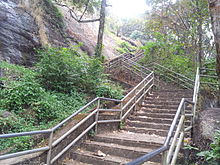
Area of Areekkal Waterfalls in Koothattukulam, Ernakulam District, Kerala