
Mirganj is a town and a notified area in Gopalganj district in the Indian states of Bihar.
|
Mirganj
|
|
|---|---|
|
Town
|
|
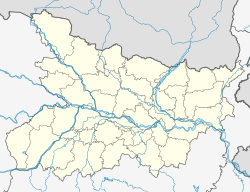
 Mirganj
Location in Bihar, India
|
|
| Coordinates: 26°21′50″N 84°21′50″E. | |
| Country |  India India |
| State | Bihar |
| District | Gopalganj |
| Government | |
| • Body | Nagar parishad |
| Area | |
| • Total | 5.48 km2 (2.12 sq mi) |
| Elevation | 66 m (217 ft) |
| Population
(2011)
|
|
| • Total | 26,240 |
| • Density | 4,800/km2 (12,000/sq mi) |
| Languages | |
| • Official | Hindi, Urdu[2] |
| Time zone | UTC+5:30 (IST) |
| PIN |
841438[3]
|
| ISO 3166 code | IN-BR |
| Vehicle registration | BR-28 |
| Lok Sabha constituency | Gopalganj |
| Vidhan Sabha constituency | Hathua |

Geography
It’s located at 26°21′50″N 84°21′50″E, It has an average elevation of 66 metres (217 ft).It occupies an area of 5.48 square kilometres (2.12 sq mi).
Demographics
As of the 2011 Census of India, This town had a population of 26,240, of which 13,427 are males while 12,813 are females. Population within the age group of 0 to 6 years was 4,015 which is 15.30% of total population of the town. it had an average literacy rate of 65%, higher than the state average of 61.8% with male literacy of 55.43%, and female literacy was 44.57%.
Bhojpuri, Hindi is the locally spoken language here.