
A district (zilā) is an administrative division of an Indian state or territory. In some cases districts are further subdivided into sub-divisions, and in others directly into tehsils or talukas. As of 2021 there are a total of 718 districts, up from the 640 in the 2011 Census of India and the 593 recorded in the 2001 Census of India.
District officials include:
- District Magistrate or Deputy Commissioner or District Collector, an officer of the Indian Administrative Service, in charge of administration and revenue collection
- Superintendent of Police or Senior Superintendent of Police or Deputy Commissioner of Police, an officer belonging to the Indian Police Service, responsible for maintaining law and order
- Deputy Conservator of Forests, an officer belonging to the Indian Forest Service, entrusted with the management of the forests, environment and wildlife of the district
Each of these officials is aided by officers from the appropriate branch of the state government.
Most districts have a distinct headquarters; but the districts of Mumbai City, in Maharashtra, Hyderabad in Telangana and Chennai, in Tamil Nadu, are examples where there is no distinct district headquarters, although there are district collectors.
Overview
|
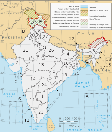
A clickable map of the 28 states and 8 union territories of India
|
Naming
|
|
This section does not cite any sources. (January 2021)
|
The majority of districts are named after their administrative centre. Some are referred to by two names, a traditional one and one that uses the name of the town that is the headquarters. Since most of the districts are named after a town, the word “district” is appended to distinguish between the town and the district.
Similar names
- The names of the districts are mostly unique. However, some districts share their name with another district in India:
- Aurangabad district, Bihar and Aurangabad district, Maharashtra
- Bijapur district, Karnataka and Bijapur district, Chhattisgarh
- Balrampur district, Chhattisgarh and Balrampur district, Uttar Pradesh
- Bilaspur district, Chhattisgarh and Bilaspur district, Himachal Pradesh
- Chittoor district, Andhra Pradesh and Chittorgarh district, Rajasthan.
- Hamirpur district, Himachal Pradesh and Hamirpur district, Uttar Pradesh
- Pratapgarh district, Rajasthan and Pratapgarh district, Uttar Pradesh
- Raigarh district, Chhattisgarh and Raigad district, Maharashtra
- Some districts share their name with a district in a neighbouring country in South Asia:
- Bhojpur district, Bihar shares a name with Bhojpur District, Nepal
- Daman district, Dadra and Nagar Haveli and Daman and Diu shares a name with Daman District, Afghanistan
- Dang district, Gujarat shares a name with Dang District, Nepal
- Ghaziabad district, Uttar Pradesh shares a name with Ghaziabad District, Afghanistan
- Gopalganj district, Bihar shares a name with Gopalganj District, Bangladesh
- Hyderabad district, Telangana shares a name with Hyderabad District, Pakistan
- Lalitpur district, Uttar Pradesh shares a name with Lalitpur District, Nepal
- Poonch district, Jammu and Kashmir, shares a name with Poonch District, Pakistan (the two were, prior to Partition, one district – which got split by the Line of Control, since then the two parts have been administered separately)
- A few districts share names with those outside of South Asia entirely:
- Dhar district, Madhya Pradesh, with Dhar District, Yemen
- Banda district, Uttar Pradesh with Banda District, Republic of the Congo and Banda District, Ghana
- Mansa district, Punjab, with Mansa District, Zambia.
- Salem district, Tamil Nadu with Salem district, Massachusetts, United States and Salem, Oregon, United States
- In some districts the name of the district headquarters is different from that of the district:
- East Godavari district in Andhra Pradesh, its headquarters being Kakinada.
- West Godavari district in Andhra Pradesh, its headquarters being Eluru.
- Krishna District district in Andhra Pradesh, its headquarters being Machilipatnam.
- Ganjam district in Odisha state, its headquarters being Chhatrapur.
- Mahendergarh district in Haryana state, its headquarters being Narnaul.
- Prakasam district in Andhra Pradesh, its headquarters being Ongole
- Dakshina Kannada district in Karnataka state, its headquarters being Mangalore.
- Uttara Kannada district in Karnataka state, its headquarters being Karwar.
- Kodagu district in Karnataka state, its headquarters being Madikeri.
- Sindhudurg district in Maharashtra state, its headquarters being Oros.
- Kanyakumari district in Tamil Nadu state, its headquarters being Nagercoil (although there is a town named Kanyakumari).
- Nilgiris district in Tamil Nadu state, its headquarters being Udagamandalam.
- Wayanad district of Kerala with its headquarters at Kalpetta.
- Vaishali district in Bihar state, its headquarters being Hajipur.
- Ambedkar Nagar district in Uttar Pradesh, its headquarters being Akbarpur, Ambedkar Nagar.
- Amethi district in Uttar Pradesh, its headquarters being Gauriganj.
- Farrukhabad district in Uttar Pradesh, its headquarters being Fatehgarh.
- Gautam Buddha Nagar district in Uttar Pradesh, its headquarters being Greater Noida.
- Jalaun district in Uttar Pradesh, its headquarters being Orai.
- Kanpur Dehat district in Uttar Pradesh, its headquarters being Akbarpur, Kanpur Dehat.
- Kanpur Nagar district in Uttar Pradesh, its headquarters being Kanpur.
- Kaushambi district in Uttar Pradesh, its headquarters being Manjhanpur.
- Sant Kabir Nagar district in Uttar Pradesh, its headquarters being Khalilabad.
- Bhadohi district in Uttar Pradesh, its headquarters being Gyanpur.
- Sonbhadra district in Uttar Pradesh, its headquarters being Robertsganj.
- Sirmaur district in Himachal Pradesh, its headquarters being Nahan.
- Kheri district in Uttar Pradesh, its headquarters being lakhimpur.
-
- East Nimar district in Madhya Pradesh, its headquarters being Khandwa.
- West Nimar district in Madhya Pradesh, its headquarters being Khargone.
- Singrauli district in Madhya Pradesh, its headquarters being Waidhan.
- Koriya district in Chhattisgadh, its headquarters being Baikunthpur.
- GPM district in Chhatisgarh, its headquarters being Pendra.
- Bastar district in Chattisgarsh, its headquarters being Jagadalpur.
- Balrampur district in Chhatisgarh, its headquarters being Ramanujganj.
The following tables list the population details of various states. The columns include the hierarchical administrative subdivision codes, the district name, district headquarters, 2011 census population, area in square kilometres, and the population density per square kilometre.
States
Andhra Pradesh (AP)
| # | Code | District | Headquarters | Population (2021) |
Area (km2) |
Density (/km2) |
|---|---|---|---|---|---|---|
| 1 | AN | Anantapur | Anantapur | 4,083,315 | 19,130 | 213 |
| 2 | CH | Chittoor | Chittoor | 4,170,468 | 15,152 | 275 |
| 3 | EG | East Godavari | Kakinada | 5,151,549 | 10,807 | 477 |
| 4 | GU | Guntur | Guntur | 4,889,230 | 11,391 | 429 |
| 5 | CU | Kadapa | Kadapa | 2,884,524 | 15,359 | 188 |
| 6 | KR | Krishna | Machilipatnam | 4,529,009 | 8,727 | 519 |
| 7 | KU | Kurnool | Kurnool | 4,046,601 | 17,658 | 229 |
| 8 | PR | Prakasam | Ongole | 3,392,764 | 17,626 | 192 |
| 9 | NE | Sri Potti Sriramulu Nellore | Nellore | 2,966,082 | 13,076 | 227 |
| 10 | SR | Srikakulam | Srikakulam | 2,699,471 | 5,837 | 462 |
| 11 | VS | Visakhapatnam | Visakhapatnam | 4,288,113 | 11,161 | 384 |
| 12 | VZ | Vizianagaram | Vizianagaram | 2,342,868 | 6,539 | 358 |
| 13 | WG | West Godavari | Eluru | 3,934,782 | 7,742 | 490 |
Arunachal Pradesh (AR)
| # | Code | District | Headquarters | Population (2011) |
Area (km2) |
Density (/km2) |
|---|---|---|---|---|---|---|
| 1 | AJ | Anjaw | Hawai | 21,089 | 6,190 | 3 |
| 2 | CH | Changlang | Changlang | 147,951 | 4,662 | 32 |
| 3 | EK | East Kameng | Seppa | 78,413 | 4,134 | 19 |
| 4 | ES | East Siang | Pasighat | 99,019 | 3,603 | 27 |
| 5 | – | Kamle | Raga | 22,256 | 200 | 111 |
| 6 | – | Kra Daadi | Jamin | – | – | – |
| 7 | KK | Kurung Kumey | Koloriang | 89,717 | 6,040 | 15 |
| 8 | – | Lepa Rada | Basar | – | – | – |
| 9 | EL | Lohit | Tezu | 145,538 | 2,402 | 61 |
| 10 | LD | Longding | Longding | 60,000 | 1,200 | 50 |
| 11 | DV | Lower Dibang Valley | Roing | 53,986 | 3,900 | 14 |
| 12 | – | Lower Siang | Likabali | – | – | – |
| 13 | LB | Lower Subansiri | Ziro | 82,839 | 3,508 | 24 |
| 14 | – | Namsai | Namsai | 95,950 | 1,587 | 60 |
| 15 | – | Pakke-Kessang | Lemmi | – | – | – |
| 16 | PA | Papum Pare | Yupia | 176,385 | 2,875 | 61 |
| 17 | – | Shi Yomi | Tato | 13,310 | 2,875 | 5 |
| 18 | – | Siang | Pangin | 31,920 | 2,919 | 11 |
| 19 | TA | Tawang | Tawang | 49,950 | 2,085 | 24 |
| 20 | TI | Tirap | Khonsa | 111,997 | 2,362 | 47 |
| 21 | UD | Upper Dibang Valley | Anini | 7,948 | 9,129 | 1 |
| 22 | US | Upper Siang | Yingkiong | 35,289 | 6,188 | 6 |
| 23 | UB | Upper Subansiri | Daporijo | 83,205 | 7,032 | 12 |
| 24 | WK | West Kameng | Bomdila | 87,013 | 7,422 | 12 |
| 25 | WS | West Siang | Along | 112,272 | 8,325 | 13 |
- ^ Kamle district was created in 2017 after bifurcation from Lower Subansiri district.
- ^ Kra Daadi district was created in 2015 after bifurcation from Kurung Kumey district.
- ^ Lepa Rada district was created in 2018 after bifurcation from Lower Siang district.
- ^ Lower Siang district was created in 2017 after bifurcation from West Siang & East Siang district.
- ^ Namsai district was created in 2014.
- ^ Pakke-Kessang district was created in 2018 after bifurcation from East Kameng district.
- ^ Shi Yomi district was created in 2018 after bifurcation from West Siang district.
- ^ Siang district was created in 2015.