
Presidency Division is an administrative division within the Indian state of West Bengal. The headquarters and the largest city of the Presidency division is Kolkata, the state capital. Presidency division is bounded by Medinipur division to South-West, Burdwan division to North-West and Malda division to North. The whole east side of the division is covered by Bangladesh–India border. Shri A. R. Bardhan, IAS is the current Secretary and Divisional Commissioner of the division.
Districts
It consists of 5 districts:
|
Presidency Division
|
|
|---|---|
|
Division of West Bengal
|
|

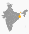
Location of Presidency Division in West Bengal
|
|
| Country | |
| State | |
| Capital | Kolkata |
| Largest City | Kolkata |
| Districts | 1. Howrah, 2. Kolkata, 3. Nadia, 4. North 24 Paraganas, 5. South 24 Parganas |
| Area | |
| • Total | 24,957 km2 (9,636 sq mi) |
| Population
(2011)
|
|
| • Total | 32,741,224 |
| • Density | 1,300/km2 (3,400/sq mi) |
| Main crops | Paddy, Jute, Pulses, Wheat, Mustard, Sesame, Sugarcane, Soybean, Onion, Vegetables, Turmeric |
Presidency Division is an administrative division within the Indian state of West Bengal. The headquarters and the largest city of the Presidency division is Kolkata, the state capital. Presidency division is bounded by Medinipur division to South-West, Burdwan division to North-West and Malda division to North. The whole east side of the division is covered by Bangladesh–India border. Shri A. R. Bardhan, IAS is the current Secretary and Divisional Commissioner of the division.[1]
Districts
It consists of 5 districts:[
| Code[3] | District | Headquarters | Established | Subdivisions | Area | Population 2011[4] | Population Density | Map |
|---|---|---|---|---|---|---|---|---|
| HR | Howrah | Howrah | 1947 |
|
1,467 km2 (566 sq mi) | 4,850,029 | 3,306/km2 (8,560/sq mi) |
 |
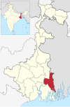
| KO | Kolkata | Kolkata | 1947 | — | 185 km2 (71 sq mi) | 4,486,679 | 24,252/km2 (62,810/sq mi) |
 |
| NA | Nadia | Krishnanagar | 1947 |
|
3,927 km2 (1,516 sq mi) | 5,168,488 | 1,316/km2 (3,410/sq mi) |
 |
| PN | North 24 Parganas | Barasat | 1986 |
|
4,094 km2 (1,581 sq mi) | 10,082,852 | 2,463/km2 (6,380/sq mi) |
 |
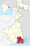
| PS | South 24 Parganas | Alipore | 1986[6] |
|
9,960 km2 (3,850 sq mi) | 8,153,176 | 819/km2 (2,120/sq mi) |
 |
| Total | — | — | — | 23 | 24,957 km2 (9,636 sq mi) | 32,741,224 | 1,312/km2 (3,400/sq mi) |
 |
Demographics
Hindus form the majority of the population. Muslims form the largest minority in this division. They are mainly concentrated in Basirhat subdivision of Uttar 24 Pargana district, Tehatta subdivision and Krishnanagar Sadar subdivision of Nadia district and Diamond Harbour subdivision and Baruipur subdivision of Dakshin 24 Pargana district.